Showing posts with label India. Show all posts

Sunday, July 16, 2017

Khimsar - A Small Sand Dunes Village In The Midst of The Great Indian Desert


With the invasion of Mohammad Ghori in 1194, the Kanauj king, Jaichand was defeated whose grandson Sheoji in 1226 in search of a fresh battlefield moved to region around Mandore & conquered some parts of it until 1395 when the twelfth ruler of the dynasty, Chunda acquired full territorial rights of the region around Mandore and it was thereafter known famously as the Rathore Dynasty. In 1459, Rao Jodha was advised to shift his capital base to some hilltop to avoid rising war pressure from external enemies. Subsequently, he built the fort of Mehrangarh and named the human settlement which flourished around it as Jodhpur under the legacy of his own name. In 1465, Rao Bika, the eldest son of Rao Jodha left Jodhpur and built a small fort Rati Ghati in 1485 at a site near to the famous rat temple of Karni Mata which eventually developed itself into Bikaner. Another son of Rao Jodha, Rao Karamsji got encouraged by both his father’s and his brother’s endeavours of building forts and palaces and he moved towards Nagaur which lies somewhere in the middle of the two fort cities built by his family, Jodhpur and Bikaner and built a fort near to the presently lying sand dunes village of Khimsar. It didn’t had any ladies wing however till the middle of the eighteenth century when a zenana mahal was added to the existing structure and the royal family moved here thereafter. Another regal wing was added to it by Thakur Onkar Singh in 1940s. 


Different staggered and distant lying houses and other structures were rising into their existence simultaneously as the development of the fort was undergoing but it remained sparsely populated owing to the characteristics of the site - a state of geographical bewilderment and a small sand dunes village sprouted itself over the period of time in the form of Khismar. The fort was subsequently converted into a heritage hotel offering a chance to the visitors  to experience the lifestyle of the royal families of medieval times. 

Khimsar lies around 100 km North-East of Jodhpur on Jodhpur-Bikaner highway and beholds in itself contrasting images of a beautiful royal palace built to showcase power and wealth on one hand and village shelter houses on the other in the midst of the Great Indian Desert. The material used for construction of the houses is earth and thatch in general which are known to provide a cooling effect which is much needed in the heats of a desert. There also lies a BlackBuck Reserve in its vicinity which has three species of antelopes in itself - the BlackBuck, the Chinkara and the BlueBull. As defined by one of the writers, Khimsar is ‘rustic in appearance, in consonance with its surroundings & these luxurious huts which has been designed to remain eco-friendly’ adds to the overall beauty of the desert which provides in a glimpse of eternity and infinity like the sky above does for keen eyes. 


Images from khimsar, indianholiday, tourism-of-india, itchotels, itchotels, rajasthandirect, khimsar, bp, hotelsinjodhpur, tourismeveryone, trip advisor, goindiaholiday & bp (top to bottom)

Friday, July 7, 2017

Hrishikesh - An Ancient Indian Knowledge Centre Which Eventually Became Yoga Capital Of The World


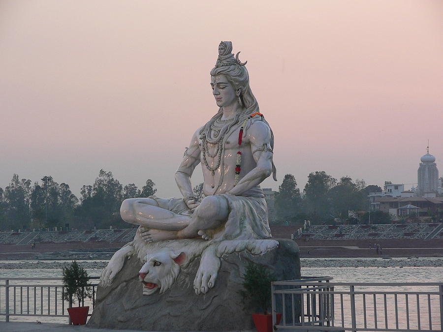
The literature written during the 3rd & the 10th century AD by the Indian society is commonly termed to as ‘Puranas’  which were collectively like an encyclopaedia of that phase of Indian human development which wasn’t all about gods and goddesses as generally thought of as but they also discussed a wide range of disciplines like cosmology, astronomy, grammar, mineralogy, philosophy, etc, to name some making them one of the earliest multi-disciplinary writings of the mankind. The original content however was written in different interpretations by different writers over different phases making it highly inconsistent over the course of time. There are eighteen major Puranas out of which SkandaPurana is the largest one which alongside providing other informations compiles in itself an encyclopaedic travel handbook with meticulous Tirtha Mahatmaya (pilgrimage tourist guide) which contained geographical locations, historical contexts, etc, of pilgrimage centres of India, Nepal and Tibet. In SkandaPurana, one such pilgrimage site has been referred to as Kubjāmraka which went on to adopt its modern name of Hrishikesh at a later part of history when Raibhya Rishi, a sage is said to be given an appearance of Lord Vishnu, a Hindu God as Lord Hrishikesh as a result of his performed austerities. There are other versions for the etymology of its modern name as well but this is one of the most widely accepted ones. Hrishikesh literally means the lord of senses (Hrishik in Sanskrit means senses and ish is referred to as the lord) though its generally took as the hairs of a sage both by the local population & those visiting it from foreign lands in contemporary times.

Hrishikesh has traditionally been a pilgrimage site and was part of the legendary ‘KedarKhand’ of the above mentioned SkandaPurana but got into highlight when Adi Shankaracharya, a human visionary who later was responsible for the establishment of various Hindu Matths across all the directions of India visited the place in the eighth  century during his journey towards Kedarnath - a Shiva temple in the higher Himalayas and it thereafter became a common hotspot for the sages and the seers serving them with different purposes - as a stopping point towards their journey of the upper Himalayas and also as a discussion place for developing the knowledge and wisdom of the then collective human consciousness. He built the temple of Bharat (the brother of Lord Rama) whose is also said to have visited the place as per the Indian literary texts of Ramayana which was later on destroyed by Taimur in his Indian invasion of 1398. The famous jute rope bridge commonly known as Lakshman Jhoola, a 450 feet spanned bridge connecting the two villages of Tapovan and Jonk on two sides of the River Ganga was replaced by an iron rope suspension bridge in 1889 which subsequently was replaced by an another stronger version of it when it got washed away during the floods of 1924. Another similar bridge was built in 1986 at around 2 kms. downstream of the river from Lakshman Jhoola.

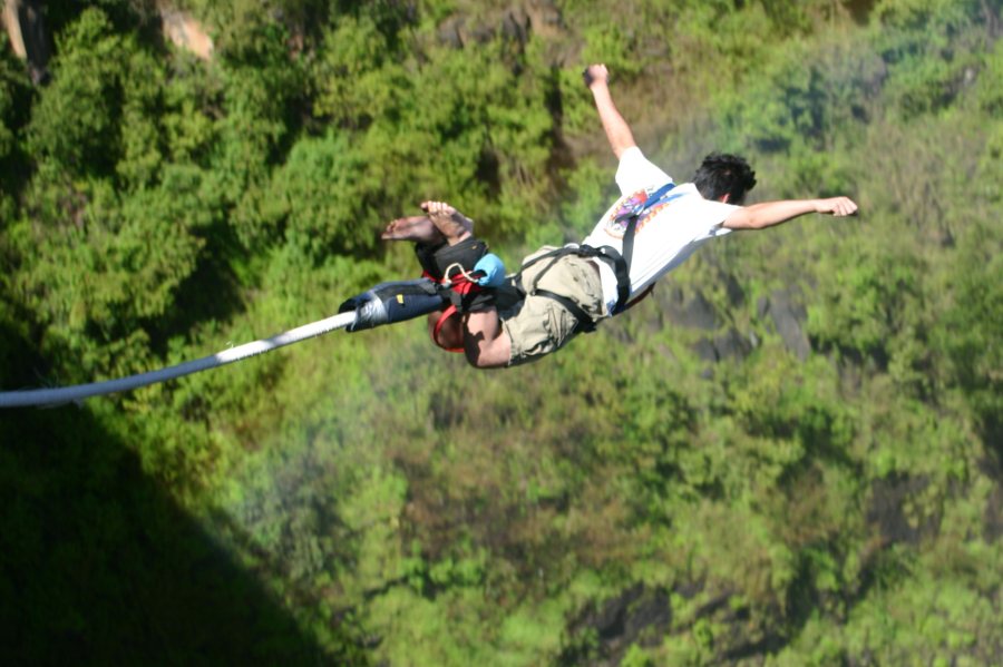
The largest river of India in terms of its in-boundary catchment area Ganga flows through the city which has been one of the main reasons behind the existence of human settlement over here from ancient times & it leaves the Shivalik Ranges of Himalayas here to flow through the great Northern Indian Plains. Hrishikesh lies in the Indian state of Uttarakhand 35 kms from Haridwar and around 250 kms from the national capital of New Delhi. Due to its historicity, there are various architectural built-ups in the forms of temples, aashramas, etc,. which has only increased its global presence over the period of time. In a recent development of 2015, the Indian government has announced to develop the twin cities of Haridwar and Hrishikesh as natural heritage twin cities to attract tourist furthermore - the nature of whom has transformed majorly towards being tourists with their primary interest in adventure tourism in present times especially that of the local visitors with the onset of various such activities providing agencies which has traditionally been a centre of serenity, knowledge & wisdom. 


The centres and institutions providing teachings of Yoga (a state of Union) has also increased substantially with the increasing number of foreign tourists visiting the place to decipher the Indian perspective of spirituality in the past couple of decades with the ever increasing globalisation which brings along with itself an ease in long distance human mobility - transforming it to as a Global Hotspot of Higher Spiritual Studies at first and as the Yoga Capital of the World eventually - a title which it rightly deserves in many senses. In recent times various other forms of therapy sciences & healing processes has also found their base in the boundaries of the city which are nothing but healing instruments for specific type of ailments or pains especially after the announcement of 21st June as the International Day of Yoga by the United Nations. The population of the census town of Hrishikesh was 8,033 as per the Indian census of 2011 while that of the entire district was around 70,000 in 2011 which crossed the mark of 100,000 in 2016 as reported by different individual institutions. Hrishikesh imbibes in itself inspirational vibes of some higher order and its historicity provides it a perfect platform for flourishing the quality of ones consciousness level where historically the community of the mankind has lived along a life in the spheres of answering the questions of knowledge, spirituality & wisdom. It can also be stated to as one of the earliest identified and inhabited hill stations of the Indian subcontinent and the heritage of this nature shall be preserved and conserved to the maximum of our abilities so as to lengthen its role which it has played in the story of human development & settlements. 


Images from haridwarrishikeshtourismbizimages, ytimgmouthshuttapovanresort & yogainrishikesh (in the order from top to down)

Tuesday, June 13, 2017

Nako - A Himalayan Human Settlement With Its Private Natural Lake


During the second wave of diffusion of Buddhism in Tibet, Rinchen Zangpo was a principal translator of Sanskrit Buddhist texts into Tibetan. He wasn’t a born Buddhist by belief but his parents supported him in his quest of knowing the world and he came to India to study Buddhism. He is said to be responsible for building various monasteries thereafter including Tabo in the Spiti Valley & Poo in Kinnaur in the Indian state of Himachal Pradesh. In 956 AD, a monastery in Nako was build under the inspiration and supervision of the same which eventually accompanied the small human settlement of Nako to sustain and receive its specific identity in the form of Buddhism and its teachings. The monastery at Nako presents a testimony and is different from other sister monasteries in a way that it showcases the Vajranya Buddhist iconography.


Nako lies along the backdrop of Res Purgyal which is the highest mountain of this particular Indian state facing an oval shaped natural lake. The total population of the village in 2002 was 416 and the main occupation of the local community has been agriculture especially in the form of Apples and Sun Dried Apricots while tourism has added to the list lately. Nako for centuries has remained majorly a close knitted community where not many things have changed except the nature of the tourist which used to be traditionally spiritual in nature due to the presence of the monastery to one-day fun & adventure tourists in contemporary times in general. 


SaveSave

Saturday, December 31, 2016

Ahmedabad - The First Indian World Heritage City Which Was Once Known As Karnavati

Pulakesin-I in 543 AD took over the control of the town of Vatapi, the modern day Badami in the Bijapur District of Indian Republic and founded a dynasty named as Chalukyas, the etymology of which has different narratives attached to it - one goes with the birth of the clan getting its birth from ‘chaluka’ (palm) of Lord Brahma. The Chalukyas were defeated by the RashtraKutas around two centuries later until Tailapa II, a Chalukyan scion restored the family of his ancestors to its former glory & laid the foundations for the Chalukyas with their capital at Kalyani generally termed to as the Western Chalukyas. In the 10th century, Chavda dynasty was ruling the region of present day Northern Gujarat, who were supplanted by MulaRaja, another Chalukyan scion, possibly due to his relations with Samanta Sinha, the ruler of AnahilaPataka which is now known as Patan (in the northern Gujarat) - some sources suggests that he had adopted MulaRaja. MulaRaja established his capital at Patan in 940-41 AD which was already a fortified town till than developed by the prominent Chavda king Vanraj Chavda.    
BhimaRaja succeeded MulaRaja who built the Sun Temple at Modhera which is now identified as the world heritage site. After his death, Rani ki Vav (a stepped well) was built by his wife & his son KarnaDeva who ascended the throne after him & defeated the Bhil chieftain of Ashavalli & established the city of KarnaVati - the city of Karna on the banks of river Sabarmati. His son Jayasimha later on added many architectural structures to the city as per a 12th century renowned writer Hemachandra who quoted about a lake built by his predecessor Durlabha which he renovated and named it Sahastralinga, literally meaning thousands of lingas (the symbol of Lord Shiva). Hemachandra says that it was not just a lake but also a great architectural beauty. He diverted the flow of the entire Saraswati River into the lake. Many artificial islands were created on which many temples, palaces, and gardens were built. Apart from these, there were 108 temples to Devi, Yagnashala and Matha for pupils. The son of Jayasimha's daughter, Someshvara (the father of Prithviraj Chauhan, who later sat on the central throne of Delhi) was brought up by Jayasimha at the Chaulukyan court.  

JaySimha ruled for around half of the century till 1142 AD and Solankis continued their rule over the region until the 13th century when the Vaghelas of Dwarka overpowered them whose rule ended soon in 1299 when Zafar Khan, the governor of the central Delhi Sultanate took the opportunity to establish himself as sultan of an independent Gujarat in times when the central throne was getting weakened due to the sacking of Taimur & established Muzaffarid dynasty. His son, Ahmed Shah developed his capital city at KarnaVati who destroyed many architectural structures as mentioned in the medieval literature & history, built and added new structures of a different school of architecture and renamed the city as Ahmedabad after his own name in 1487 AD. He built another city Ahmednagar which lies in the present day district of Saurashtra of the Indian state of Maharashtra. He fortified the city of Ahmedabad with an outer wall of 6 miles in circumference consisting of 12 gates, 189 bastions & over 6,000 battlements. 

Ahmedabad was ruled by the Muzaffarid dynasty until 1573 when Muzaffar II was the Sultan of Ahmedabad. Gujarat was then conquered by the Mughal emperor Akbar in 1573. During the Mughal reign, Ahmedabad became one of the Empire's thriving centres of trade, mainly in textiles, which were exported to as far as Europe. The Mughal ruler Shahjahan spent the prime of his life in the city, sponsoring the construction of the Moti Shahi Mahal in Shahibaug. A different layer of Mughal style was added to the city adding to its richness. The armies of the Maratha generals Raghunath Rao and Damaji Gaekwad captured the city and ended Mughal rule in Ahmedabad in the 17th century. The city was hence divided into two parts then - one each amongst the Peshwas and the Gaekwads. A famine in 1630 and the constant conflicts between the Peshwas and the Gaekwads virtually destroyed many parts of the city, causing its population to flee. 


The British East India Company took over the city in 1818 as a part of the conquest of India. A military cantonment was established in 1824 and a municipal government in 1858. The city took a major turn of its developmental story with the arrival of railways in 1864, when a railway link between Ahmedabad and Mumbai (then Bombay) was established by the Bombay, Baroda, and Central Indian Railways, making Ahmedabad an important junction in the traffic and trade between northern & southern India. The increased trade opportunities drove large number of people from rural areas to work in the city especially in the textile mills which eventually made it one of the most significant hubs of textile industry in India. 

The 19th century saw the rise of Mahatma Gandhi and he built Ahmedabad as one of his base stations to fight the struggle for the independence of the country. He established two Ashrams, the Kochrab Ashram near Paldi in 1915 and Satyagraha Ashram on the banks of Sabarmati in 1917. There are many instances of the city in the stories of freedom struggle thereafter including the famous Dandi March. With the arrival of independence in 1947, Ahmedabad became part of the Bombay state of Indian Republic and with the bifurcation of the state in 1960 into Gujarat and Maharashtra, the city became the capital of the former one. 


The city has since than seen a healthy rate of development and has developed into the largest city of Gujarat both in terms of population and its share in the state’s economy. Around 40% of the dyestuff factories in India are located in Ahmedabad and pharmaceutical giants like Cadila and Zydus have their base in the city providing employment to the city’s population. The city’s share in the state’s economy was around 17% in 1995 which has substantially increased from thereon. The population of the city increased to 2.15 million in 1981 in the municipal area while being 2.65 million in its agglomeration reach. As per the census of 2011, the city population increased to over double since 1981 to 5.57 million in the Ahmedabad Municipal Area and 6.35 million in its agglomeration. 

The Architecture of Ahmedabad is a retreat for the Art lovers especially those related with the field of Architecture and Planning with city providing an unique flavour of hybrid architecture ranging from the remains of the historic structures to the modern experiments of the 20th century by the Architects of the likes of Le Corbusier, Louis Kahn & BV Doshi engaging themselves in one of the most magnificent realisation of human creativity and application in relation with its shelter and natural relationship. The modern architecture has been developed and planned keeping in mind the local natural makeup of the city in general which has provided the city with its unique character especially in terms of its prevailing architecture. 


Organised water supply in Ahmedabad started off in 1891 when Dudheshwar water works was established on the eastern banks of Sabarmati a piped water supply was provided to the residential localities. With the rise in population, the city experienced enormous pressures especially after 1960’s & the city started depending on the groundwater potential of itself which led to the rise of private groundwater boring which eventually led to the decline in the groundwater levels at the rate of 2 to 3 meter annually.  


The waste generated in the city is around 2100 tonnes per day which is rising with every moment passing by and for it city led the initiative called of by the Indian Supreme Court and started daily door-to-door collection of solid waste in 700 thousand households which constitutes around 80% of the total households of the city. The city faces an intense issue of its ever increasing vehicular consumption - the city added nearly double the vehicles against the number of human beings added to the geographical boundaries of the city from 2001-2011. The total number of vehicles in the city were around 14 lakh in 2001 which doubled itself to around 28 lakh in 2011 making the vehicular rate of addition of 100% while the population growth for the same time frame was 58%. Every second person of the city holds a vehicle of his own making it one of the rank holders in terms of vehicular consumption per person amongst the Indian cities. A 60 km long Bus Rapid Transit system was developed to enhance the usage of public transportation system in 2008. 


The city is an example for depicting the significances of its history and its role in building its development story as can be seen in the case of Ahmedabad with its textile industry & climate responsive architecture - may it be the construction of the historic stepped wells or the establishment of modern buildings like IIM Ahmedabad and Institute of Indology which eventually has provided the inhabitants with a sense of belongingness and comfort both in their private shelter and the collective & shared one. The city blends harmoniously its historic heritage with its vibrant and dynamic present and for a similar reason it was inscribed in the list of World Heritage Sites of UNESCO under the title 'Historic City of Ahmedabad' in July 2017 becoming the first Indian city to get a name in it. Some other names in that list are that of Paris, Cairo, Damascus, etc,. The city presents an example that how a city can be built brick by brick while giving reverence to its locality & past & a vision for the future. The city faces many issues however which are in the directions of increasing over the period of time and their management shall be looked into through a more cohesive and inter-disciplinary perspective of human settlements in order to provide continuity and increase its life span while also increasing the quality of life of its citizens further. 


Saturday, December 24, 2016

Jaipur - The Planned Indian Heritage City Built on a Lake That Dried Once

In the early 10th century, the erstwhile ruler of Gwalior, Sodh Dev, a Kachchwaha king died leaving his son Dulha Rai behind whose throne was later usurped by his cousin Jai Singh forcing him to move out. He than started his search for a new territory to rule. During his search he met the chief of Lalsot (a small principality near Amer) who was a non-Badgujar Rajput - the Amer hills were than under the rulership of Badgujar clan of Meenas & Rajputs. The chief of Lalsot was looking for an opportunity to strengthen his position - he saw an opportunity in Dulha Rai and promptly gave his daughter’s hand to him along with a part of Dausa, a neighbouring territory, half of which was controlled by the Badgujars. He soon ousted the Badgujars in some parts of their kingship and declared Dausa as his ruling capital while giving birth to the Dhundara Kingdom which ruled for the next centuries to come over the region. 

This region was identified as part of Matsya Desh in the ancient literature as the shortest route between north India and the port cities of Gujarat and Malabar. After the death of Dulha Rai, his son Kakil Dev succeeded the throne and seized the hills of Amer from the Meenas and built the temple of Ambikeshwara Mahadev from where the etymology of Amber comes from. He built his capital city at Amber and the kingdom started flourishing. By the 17th century, the Kachchwahas strengthened their position by supporting the Mughal administration who was than ruling the central seat of Delhi of the Indian subcontinent. Raja Man Singh (who was the grandson of Raja Bharmal & made the commander in chief by Akbar of his army after his matrimonial alliance with Jodhabai, daughter of Raja Bharmal) in the 16th century and Mirza Raja Jai Singh in the 17th century contributed to the financial and cultural wealth of the kingdom through their political alliance with the Mughals.  

The death of Raja Bishan Singh on the last day of the 17th century left behind his 12 year old son Jai Singh who was declared as the ruler of Amber in 1700. He was than called during the same year by the Mughal emperor Aurangzeb as part of the central throne legacy to support him in the Deccan war against the Marathas. He after uniting his army with the help of his ministerial counsels went to the war at Khelna & Panhala in the Deccan. The Emperor was impressed by this young boy-ruler and conferred him the title of ‘Sawai’ which literary means one and a quarter. The major shift came with the death of Aurangzeb in 1907 whose son fought with each other and Shah Alam declared himself the Emperor of Delhi as Bahadur Shah. He broke the alliance with the Kachchwahas and made Amber a part of the Mughal administration renaming Amber as Mominabad. Jai Singh with the help of the ruler of Jodhpur drove out the Mughals from Amber and recovered the terittory in 1710 and since then his power started gaining prominence. 


The town near the fort of Amber started getting congested in the 18th century and a need for shifting the capital city raised out also to improve the trading economy of the kingdom. He also wanted to make a strong political statement at par with the Mughal cities eyeing to make it a commercial hub of the region. The site selected for the same purpose was a valley located south of Amber and the plains beyond, a terrain that was the bed of a dried lake. The dense forest cover towards the north and the east also left him with limited options. The physical constraints of the city were determined by the location of the fort of Jaigarh towards the north and the sacred spot of Galtaji towards the east. Jaipur - the city of victory got its name from its founder Raja Sawai Jai Singh. 

Besides being a great builder, he was also a great scholar of Sanskrit as well as Persian and had a deep interest in the field of Astronomy; to fulfil this, he built five ‘Observatories’ at various places namely Varanasi, Mathura, Ujjain, Delhi and Jaipur using masonry instruments of his own design which were as accurate as the brass instruments used by Newton, Flamsteed and other European astronomers at the time and when it came to building a new city from scratch he decided to plan it formally. His vision was futuristic & it can be seen by the amount of vehicular traffic it can behold in, in this advanced world of todays around three centuries later. He consulted Vidyadhar Bhattacharya for planning the city who was a scholar of Mathematics and Science from Bengal. Vidyadhar referred to ancient Indian literature, books of Ptolemy and Euclid and applied them efficiently in the construction story of Jaipur. The city was divided into nine blocks, two of which consisted of the state buildings and the remaining were allotted to the general public to live in. To facilitate water supply to the new city, the Darbhavati river in the north was dammed to create the Jai Sagar and Man Sagar (that later housed the Jal Mahal) lakes. 


The city started expanding out of its walled boundaries in the 19th century with the arrival of Sawai Ram Singh II who adopted newer modes of technological development such as the railways. He introduced gaslights on the streets, modernised drainage system and piped water supply system. In 1876, when the then Prince of Wales was to arrive in the city, he decided to paint the city in pink (by virtue of which the city was later termed to as the Pink City of India) to offer a sense of welcome to him. The colour was chosen after several experiments to cut down the intense glare from the reflection of the blazing rays of the sun in an arid zone. The expansion continued in the first half of the 20th century with the addition of different colonies outside the planned old city which were developed organically.


With the arrival of freedom in India in 1947, the four largest Rajput states of Jaipur, Jodhpur, Jaisalmer & Bikaner were combined together to form the Indian state of Rajasthan with its capital at Jaipur. The city has experienced an accelerated developmental story since then. In 1900, the city’s population has reached 1,60,000 which doubled itself in the next 60 odd years. The population of the city over the last five decades has increased over ten times which was around 3,50,000 in 1970’s raising to over 3.5 million in 2016. The city is expected to cross the mark of 4.2 million by 2025 and is predicted to shift to the 10th most populated city of India by then. 

According to the data released by NEERI, 70% of the city’s water supply receives water with a high concentration of TDS or contaminated by bacteria or both. The city whose water supply was dependent on the surface water has now turned to its groundwater potential with 90% of its total water demand being taken care by the water below the surface. As per the Centre for Science and Environment the city specifically faces problems of congestion in the old city areas, vehicular pollution, poor public transport, inadequate pedestrian and parking facilities and needs immediate solutions for these issues. 


The city has somehow tried to retain its symbolism & flavour and the future planning stints shall deeply understand the needs and aspirations of the city both on the platforms of its historicity and its future. The city beholds in a very distinct and rich language of urban sciences and efforts should be made more intensely towards integrating it with the modern mode of development. The local anthropology is a special character of the city and it should be given a worthy place in the planning exercise. The vision with which the foundations of the human settlement were laid shall also be considered and a cohesive layer of modern development shall be deciphered. The city provides a classic example of a human settlement imbibing in itself its rich cultural heritage in nearly every parts of its boundaries and it should be understood well by the fraternity concerned with human urban development. 


Saturday, December 17, 2016

Jamshedpur - The First Industrial Garden City of India

The birth of Jamshedpur predates the great urban planning experiments of the 20th century in the Indian subcontinent like New Delhi, Islamabad & Chandigarh. Jamsetji Nusserwanji Tata was looking to build a steel plant in India in the early years of the 20th century after visiting & learning about the growth of industrial towns like Manchester, Pittsburgh & others especially in the western part of the world. While his visit to Pittsburgh he met a noted geologist Charles Page Perin and he asked him to find a worthy place for the same in the Indian subcontinent. The search began in 1904 and it continued for around three years when a small village of Sakchi was found blessed with rich mineral resources like iron, coal & limestone along with a scenic picturesque of the Dalma hills. The locational aspect was also very important while finalising the site - the quick means of transportation to Calcutta Port afforded by Kalimati Railway Station (later named as Tatanagar as a legacy towards the founders of the town & their company) lied on the Calcutta-Bombay railway line was only 3 miles away. 
The vision of the city was quite clear, comprehensive & holistic in nature. Jamsetji once wrote a letter to his son Dorabji Tata (who later continued with the development of the city after the demise of Jamsetji in 1904) in 1902 quoting ‘Be Sure to lay wide streets planted with shady trees, every other of a quick growing variety. Be sure that there is plenty of space for lawns and gardens; reserve large areas for football, hockey and parks; earmark areas for Hindu temples, Mohammedan mosques and Christian churches’. His vision wasn’t just to build  an industrial town, he rather was more focused on building a livable city especially in terms of the citizens’ relationship with green spaces while allowing people from all sections of the society to build one of the first modern cosmopolitan city of India allowing them to gel them by means of open spaces with a sense of belongingness. 

The city was given its present name of Jamshedpur in 1919 to pay homage to its founder and his vision by Lord Chelmsford of whose construction officially started of in 1908. The first lay-out of the town was prepared by Julin Kennedy Sahlin of Pittsburg of America in 1912. It was designed more or less on American lines with roads at right angles and as a small industrial town with alphabetically named east-west avenues and numerically named north-south roads. The city saw its first full fledged expansion into a big industrial town in 1920, when Frederick Charles Temple, who was then the Sanitary Engineer to the Government of Bihar & a Town Planner, was engaged as the Chief Town Engineer. Temple’s work was influenced by the lifestyle of the local tribal people and also by the garden city concept of Letchworth. His design principles were also influenced by the planning of the industrial village of New Earswick. 


Due to the expansion of the steel plant in 1930 the city started facing the shortage of housing more intensely than before & the city’s plan of action got shifted towards development of housing in 1936 when Major P.C Stokes, who was connected with Quetta Reconstruction after earth-quake, was invited by the Company to advise on town planning and development. His planning principles were influenced by the ideas of Earnest Burgess who suggested the outwards expansion of a city in 1925. In 1943, Dr. Keonigsberger was invited to advise on the planning of the town. His team prepared a master plan based on garden city principles and construction of neighbourhood units. 


It employed modern urban planning principles, ushering in modernity through new modes of spatiality & lifestyles associated with industrialisation. The planning ideals included open green spaces of the garden city as an antidote to industrialisation, urban infrastructure adapted to local site conditions, neighbourhood units self-sufficient in civic amenities, and street hierarchy as a means of traffic segregation. Regionalisation of global planning ideals as well as the tension between planned development and organic growth is evident in the narrative of Jamshedpur evolving from a company town to industrial city to the present day urban agglomeration. Unlike New Delhi (of whose development started off in 1911 with the shift of the British’s empires Indian colonial capital city to Delhi), an exercise in legitimating the empire in the eye of its colonial subject, Jamshedpur was an indigenous industrial development, initiated, financed and built by Indians, using local resources and labor albeit aided by foreign expertise. 

The population of the city was just over two lakh in 1951 which has increased to over 13 lakhs as per the Indian census of 2011. The urban agglomeration of Jamshedpur has now turned into the largest urban region in the Indian state of Jamshedpur and the city has experienced tremendous growth since its inception a century over now. The city presents an approach of urban planning of whose primary objective is to build a city which would increase the productivity and living standards of its citizens. Jamshedpur was awarded by the UN Global Compact city award in 2006. The city has been predicted as the 84th fastest growing city in the world for the timeframe 2006–2020. The city is one of the most greenest cities of the country with around 27% of its area under green cover.

The city is currently facing issues of availability of potable water, rising air pollution, worsening of waste management system, etc, and these shall be looked into through a more constructive lens that being viewed in present times. There are various steps being taken by the managing body of the city which is JUSCO (Jamshedpur Utilities and Services Company) which included plantation of 1.2 million tress over the first decade of the 21st century. The city was named as the seventh cleanest city of India in 2011 which was pulled down to the lower side of the list (to the bottom 10) released by the Government of India  under its Swachch Bharat Abhiyan in 2016. The city is rated as the fourth in terms of the per capita water consumption in the Indian cities and it is now eyeing on to become India's first zero sewerage discharge city. 


The vision of the city is worth to cherish for the planning fraternity but the accelerated increase in the urbanisation levels of the state has led to the rise of urban issues and problems - the time has come to rejuvenate the city's system once again like it has done over the course of its developmental history on the platforms of inter-disciplinary perspective of human urban settlements and present a model of integrated industrial & residential mode of human development while maintaining its living standards and quality of life.