Monday, November 13, 2017

A Losing Race or A Winning Opportunity - The Battle of Human Urbanisation

A human being migrates to an urban outfit with aspirations of increased living standard and enhanced overall quality of life. But what does he receive - suspicious water supply, polluted air quality, vehicles all around on the roads, residences nearly touching the sky and what not. The migrant accepts them thinking them as a transformed way of living one’s life till he realises the cumulative trap of urban issues and problems he/she has been trapped into. Exceptions are always there and therefore barring some cities nearly every city is overdosed by technological solutions to even a minuscule of an issue rather than eyeing them as a part of the human system which itself is a part of the universal natural system. The situation gets worse in cities which without even realising their own potential blindly follow the ideas of another in the absence of proper inter-disciplinary knowledge. The planning of human settlements can become one of the toughest jobs of the universe if perceived through isolated windows with a set framework or it can become one of the easiest works to accomplish if done with an inter-dependent understanding of an urban system. 

We are in the midst of one of the biggest or simply the biggest revolution of human history. The history doesn't give any other scenario of such large scaled widespread human migration and we shall understand the intensity of the situation with an unbiased inter-dependent perspective to further plan it more efficiently. Nearly all the discussions around sustainability across the Globe seems to lack either clarity or will and though it should be at the upmost focus like generally found in present times, the arena with which it is generally viewed is too small to fight the battle of ever increasing human interference in the natural system. The ever increasing urban issues along with their sub typologies shall be taken as a warning before the bigger catastrophe takes place. The sinking of coastal cities like Jakarta, the housing shortages of cities like Mumbai, situations of traffic unrest in national capitals like Delhi, the filthy conditions of Lagos, the ever increasing density of Dhaka, the waste emergency of Naples, the increasing smoggy conditions of Delhi or Beijing in recent times are just some examples to give some perspective of its spread across all directions and to quantify the intensity to a bit.

We have beautified our settlements like never before and technology has certainly helped us to achieve the heights of comfort and ease but we shall ask some questions from ourselves - are we building our settlements to enhance our overall physical, mental and spiritual well being or are we just losing out the race already by engaging our valuable human resource in a wrong/less productive/less efficient manner? Till when we will pass on the problems from us to someone else? Till when we’ll first plan unknowingly and then rely on cursing the ever increasing complexity? Educational institutes teaching such courses shall scrutinise their outlook and shall move towards an inter-disciplinary mode of imparting knowledge rather than imparting them in isolation under different specialisations. There are already some sparks where it can be seen being adapted though slowly & being realised by the concerned authorities and fraternities but its effects can be increased acceleratingly if the global human community of those who are directly involved in shaping human lives realises the intensity of the responsibility on their shoulders and act accordingly. The objective of the human race should be universal but the approach to achieve it shall be more towards being local with necessary adaptations as per the global scenario only then we can flourish as a system to the maximum of its potential rather than planning them as different sub-systems in an unsynchronised fashion. A winning opportunity lies ahead of us to create a more empathetic, inclusive & productive Global community to gift our coming generations a space to blossom to the new glories of human progress & natural development. 


Image from amazonaws

Friday, July 28, 2017

Nuwara Eliya - The Tea Capital of Sri Lanka Also Known As The Little England of This Island Nation


Dr. John Davy was a British Surgeon who along with his other mates was once on a hunting expedition in the forest ranges lying across Mt. Pedro (locally known as Pidurutalagala) which is also the tallest mountain of the island nation of the then Ceylon in 1818 which later on was renamed as Sri Lanka in 1972. They found an elephant in the forest area, they chased him and got lost in the jungle. In the absence of food, etc, the soothing and refreshing climate of the region supported them which helped them to identify the distinctness of the region and its unique biodiversity. Dr. John Davy’s own expression of his first sight of the space was - ‘I was walking in the middle of a forest. I saw beautiful white shining diamond watered waterfalls falling. I came to the top of a mountain. The people who came with me said that it is the highest land of this country.’ He informed the regional Governor Edward Barnes about it somewhere after 1824 and presented it as a place where soldiers after exhaustive fights could rejuvenate at a faster pace. The Governor was thrilled with the idea and decided to build his own holiday home for which he spent around 8,000 pounds for its construction which has now been converted into ‘The Grand Hotel’ which was formerly known as the Barnes Hall. The developments which took place after it in the region took shape in the form of a human settlement which is now known as Nuwara Eliya which literally means the city of light. 
The city has often been referred to as the capital city of Raavan - one of the prime characters of Ramayana - an Indian epic who is mentioned to have kept Sita, the wife of Rama - the protagonist, in one of the gardens of this gloriously mentioned city made of gold & the place where he kept Sita was termed to as ‘Ashoka Vatika’ (Sita Eliya in present times). Interestingly, Dr. Davy also quoted something in parallel with the identification with which it was presented as in the Ramayana - with the tree of ‘Ashoka’ & its abundance. Further elaborating upon his first sight discussed above he mentioned that the place had so many ‘Ashoka’ trees, elephants, wild animals and gemstones suggesting some common reference between the two.

Travelling through the history, William Horton then succeeded Edward Barnes in 1831 who also acted as the editor of Colombo Journal and he wrote a few articles about Nuwara Eliya in the same which brought this human settlement into a spotlight especially amongst the foreign tourists and visitors. Samuel Baker, a British explorer who is also attached with one of the first Europeans to discover River Nile and interior of Central Africa also arrived Nuwara Eliya during the same timeframe and built a house at Magasthota and developed a huge vegetable and animal farm space. He returned then to England and came back in 1848 along with his brothers John and Valentine. He also brought plants, animals and other equipments alongside experts in the field of farming on the ‘Pearl of Hard Week’, the name of the ship. While transporting the goods from Colombo to Nuwara Eliya on bullock carts, the vehicle fell down the valley due to the steep slope near Ramboda Pass and Baker lost his accompanying brothers in that accident. Following the incident, Baker made a hospital at Nuwara Eliya and dedicated it to his brothers alongside developing his farmland. 
William Gregory became the governor of the region in 1872 and he has some big plans about Nuwara Eliya - one of them was making it the capital city of  Sri Lanka. He drained out a swamp region and developed it into a lake which came to be known as the Gregory Lake following the legacy of the human who visualised it at first. Following such announcements and things accomplished by Gregory, Nuwara Eliya began seeing an increase in the number of foreign visitors visiting this human settlement. Railways was brought in by Robert London the successor of Gregory which thereafter made accessibility to the settlement much easier. Till 1918, it was dominatingly a foreign colony with only two Sri Lankans owning houses in Nuwara in 1910. Sri Lankans started migrating to Nuwara especially after end of the First World War and the land which costed Samuel Baker around Rupees 25 per Acre is suggested to have raised upto Rupees 50,000 per Acre when Sir Ponnambalam, a local resident brought a piece of land for himself. 

The population of Nuwara Eliya crossed 7,00,000 in 2013 & it has became one of the most important tourist attractions of Sri Lanka especially due to its geographical conditions & refreshing climatic conditions which though are just an outcome of the former one. It was often termed to as the Little England by its visitors due to the predominance of the foreigners especially the Europeans till most part of its initial developmental phases. Tea which was brought to Sri Lanka in 1867 by James Taylor on a 19 acre land Loolecondera Estate in Kandy eventually became an industry of over 1.5 billion US $ as per the figures of 2013 and Nuwara Eliya led it from the front in the nation’s transformation in terms of its major economic activities and transitioned itself from being a lush green forest into the tea capital of the country and one of the major sites of the world as far as tea plantation is concerned for which the relief of the settlement has proved decisive in deciding the character and nature of the local culture and economy besides the influence caused by its ‘modern founders’. 


Sunday, July 16, 2017

Khimsar - A Small Sand Dunes Village In The Midst of The Great Indian Desert


With the invasion of Mohammad Ghori in 1194, the Kanauj king, Jaichand was defeated whose grandson Sheoji in 1226 in search of a fresh battlefield moved to region around Mandore & conquered some parts of it until 1395 when the twelfth ruler of the dynasty, Chunda acquired full territorial rights of the region around Mandore and it was thereafter known famously as the Rathore Dynasty. In 1459, Rao Jodha was advised to shift his capital base to some hilltop to avoid rising war pressure from external enemies. Subsequently, he built the fort of Mehrangarh and named the human settlement which flourished around it as Jodhpur under the legacy of his own name. In 1465, Rao Bika, the eldest son of Rao Jodha left Jodhpur and built a small fort Rati Ghati in 1485 at a site near to the famous rat temple of Karni Mata which eventually developed itself into Bikaner. Another son of Rao Jodha, Rao Karamsji got encouraged by both his father’s and his brother’s endeavours of building forts and palaces and he moved towards Nagaur which lies somewhere in the middle of the two fort cities built by his family, Jodhpur and Bikaner and built a fort near to the presently lying sand dunes village of Khimsar. It didn’t had any ladies wing however till the middle of the eighteenth century when a zenana mahal was added to the existing structure and the royal family moved here thereafter. Another regal wing was added to it by Thakur Onkar Singh in 1940s. 


Different staggered and distant lying houses and other structures were rising into their existence simultaneously as the development of the fort was undergoing but it remained sparsely populated owing to the characteristics of the site - a state of geographical bewilderment and a small sand dunes village sprouted itself over the period of time in the form of Khismar. The fort was subsequently converted into a heritage hotel offering a chance to the visitors  to experience the lifestyle of the royal families of medieval times. 

Khimsar lies around 100 km North-East of Jodhpur on Jodhpur-Bikaner highway and beholds in itself contrasting images of a beautiful royal palace built to showcase power and wealth on one hand and village shelter houses on the other in the midst of the Great Indian Desert. The material used for construction of the houses is earth and thatch in general which are known to provide a cooling effect which is much needed in the heats of a desert. There also lies a BlackBuck Reserve in its vicinity which has three species of antelopes in itself - the BlackBuck, the Chinkara and the BlueBull. As defined by one of the writers, Khimsar is ‘rustic in appearance, in consonance with its surroundings & these luxurious huts which has been designed to remain eco-friendly’ adds to the overall beauty of the desert which provides in a glimpse of eternity and infinity like the sky above does for keen eyes. 


Images from khimsar, indianholiday, tourism-of-india, itchotels, itchotels, rajasthandirect, khimsar, bp, hotelsinjodhpur, tourismeveryone, trip advisor, goindiaholiday & bp (top to bottom)

Friday, July 14, 2017

Duong Lam - An Early Medieval Vietnamese Village Also Known As A Living Museum of Converted Laterite


Phùng Hưng got his birth with a prodigious physical strength in a rich family in 761 AD who at the age of thirty along with his brother Phùng Hải and Đỗ Anh Hàn, a military strategist led a rebellion against the long ruling Chinese Tang Dynasty in Vietnam since 111 BC and seized the headquarters of the An nam Protectorate which was being administered by a corrupt military leader Cao Chính Bình who shortly died himself due to an illness and power crisis. Phun Hung became the military governor of An nam and a semi-autonomous ruler of the region for a short span of 11 years & his son succeeded him but he couldn’t resist for long and the declining Tang Dynasty found its roots again in the region. The local population were only given a glimpse of independence for a shorter span until 939 when another villager from the same village Duong Lam, where Phun Hung was born, Ngo Quyen proclaimed himself as the King of An Nam, the southernmost province of China during the Tang Dynasty. He founded the first Vietnamese Dynasty in the form of Ngo Dynasty  and renamed the presently known Vietnam as Dai Viet.

Duong Lam is now a commune of Son Tay Town in the region of Hanoi - the national capital of Vietnam. It beholds in itself some houses dating back to as minimum as 300 years which are made up of laterite and clay, both found locally in abundance - the latter was available in the ponds and water bodies present in the vicinity. Its a living example presenting a case of a community and its lifestyle in early medieval times of human developmental story as an agriculture community (rice being the primary source). The structure of a normal ancient house of Duong Lam includes a main gate, a garden, a yard, a main living house, an out building, a kitchen and a livestock barn. Duong Lam has 956 traditional houses built out of blocks of laterite presenting itself to the world as a Museum of Converted Laterite & Clay - the newly built houses has only added to the overall cultural beauty by building in the similar fashion in general. Most of the old houses had a secret door connecting it to the communal house which is a place of worship of the community. All roads and alleys of the village were planned to prevent theft and crime. The roads and the form used in them were special in some parts in the shapes of the bones of a fish out of which few such are preserved till date. There used to be a common well for a group of people - each house has its own in present times but the former one is well preserved by the community as a sign of marked imprints of their ancestors. In 2005, Duong Lam was organised as a complex of national importance by Vietnam which also consist of a set five other villages of the same category - Mong Phu, Dong Sang, Cam Thinh, Doai Giap & Cam Lam. 


Friday, July 7, 2017

Hrishikesh - An Ancient Indian Knowledge Centre Which Eventually Became Yoga Capital Of The World


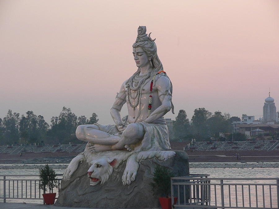
The literature written during the 3rd & the 10th century AD by the Indian society is commonly termed to as ‘Puranas’  which were collectively like an encyclopaedia of that phase of Indian human development which wasn’t all about gods and goddesses as generally thought of as but they also discussed a wide range of disciplines like cosmology, astronomy, grammar, mineralogy, philosophy, etc, to name some making them one of the earliest multi-disciplinary writings of the mankind. The original content however was written in different interpretations by different writers over different phases making it highly inconsistent over the course of time. There are eighteen major Puranas out of which SkandaPurana is the largest one which alongside providing other informations compiles in itself an encyclopaedic travel handbook with meticulous Tirtha Mahatmaya (pilgrimage tourist guide) which contained geographical locations, historical contexts, etc, of pilgrimage centres of India, Nepal and Tibet. In SkandaPurana, one such pilgrimage site has been referred to as Kubjāmraka which went on to adopt its modern name of Hrishikesh at a later part of history when Raibhya Rishi, a sage is said to be given an appearance of Lord Vishnu, a Hindu God as Lord Hrishikesh as a result of his performed austerities. There are other versions for the etymology of its modern name as well but this is one of the most widely accepted ones. Hrishikesh literally means the lord of senses (Hrishik in Sanskrit means senses and ish is referred to as the lord) though its generally took as the hairs of a sage both by the local population & those visiting it from foreign lands in contemporary times.

Hrishikesh has traditionally been a pilgrimage site and was part of the legendary ‘KedarKhand’ of the above mentioned SkandaPurana but got into highlight when Adi Shankaracharya, a human visionary who later was responsible for the establishment of various Hindu Matths across all the directions of India visited the place in the eighth  century during his journey towards Kedarnath - a Shiva temple in the higher Himalayas and it thereafter became a common hotspot for the sages and the seers serving them with different purposes - as a stopping point towards their journey of the upper Himalayas and also as a discussion place for developing the knowledge and wisdom of the then collective human consciousness. He built the temple of Bharat (the brother of Lord Rama) whose is also said to have visited the place as per the Indian literary texts of Ramayana which was later on destroyed by Taimur in his Indian invasion of 1398. The famous jute rope bridge commonly known as Lakshman Jhoola, a 450 feet spanned bridge connecting the two villages of Tapovan and Jonk on two sides of the River Ganga was replaced by an iron rope suspension bridge in 1889 which subsequently was replaced by an another stronger version of it when it got washed away during the floods of 1924. Another similar bridge was built in 1986 at around 2 kms. downstream of the river from Lakshman Jhoola.

The largest river of India in terms of its in-boundary catchment area Ganga flows through the city which has been one of the main reasons behind the existence of human settlement over here from ancient times & it leaves the Shivalik Ranges of Himalayas here to flow through the great Northern Indian Plains. Hrishikesh lies in the Indian state of Uttarakhand 35 kms from Haridwar and around 250 kms from the national capital of New Delhi. Due to its historicity, there are various architectural built-ups in the forms of temples, aashramas, etc,. which has only increased its global presence over the period of time. In a recent development of 2015, the Indian government has announced to develop the twin cities of Haridwar and Hrishikesh as natural heritage twin cities to attract tourist furthermore - the nature of whom has transformed majorly towards being tourists with their primary interest in adventure tourism in present times especially that of the local visitors with the onset of various such activities providing agencies which has traditionally been a centre of serenity, knowledge & wisdom. 


The centres and institutions providing teachings of Yoga (a state of Union) has also increased substantially with the increasing number of foreign tourists visiting the place to decipher the Indian perspective of spirituality in the past couple of decades with the ever increasing globalisation which brings along with itself an ease in long distance human mobility - transforming it to as a Global Hotspot of Higher Spiritual Studies at first and as the Yoga Capital of the World eventually - a title which it rightly deserves in many senses. In recent times various other forms of therapy sciences & healing processes has also found their base in the boundaries of the city which are nothing but healing instruments for specific type of ailments or pains especially after the announcement of 21st June as the International Day of Yoga by the United Nations. The population of the census town of Hrishikesh was 8,033 as per the Indian census of 2011 while that of the entire district was around 70,000 in 2011 which crossed the mark of 100,000 in 2016 as reported by different individual institutions. Hrishikesh imbibes in itself inspirational vibes of some higher order and its historicity provides it a perfect platform for flourishing the quality of ones consciousness level where historically the community of the mankind has lived along a life in the spheres of answering the questions of knowledge, spirituality & wisdom. It can also be stated to as one of the earliest identified and inhabited hill stations of the Indian subcontinent and the heritage of this nature shall be preserved and conserved to the maximum of our abilities so as to lengthen its role which it has played in the story of human development & settlements. 


Images from haridwarrishikeshtourismbizimages, ytimgmouthshuttapovanresort & yogainrishikesh (in the order from top to down)

Thursday, July 6, 2017

Hahoe - A South Korean Folk Village Enveloped by Water


Yi Seonggye, the main figure behind overthrowing of the Goryeo Dynasty of Korea founded the Kingdom of Joseon in 1392. He was a son of a minor Mongol official from Korea and a Chinese mother. The span of the reign ship of the kingdom established by him lasted for over five centuries when it ended in 1897 when it was officially renamed as the Korean Empire. When the kingdom was growing, a small clan titling themselves as Ryu established their base in one of the sites near the present day bigger city of Andong and named it as Hahoe - 'Ha' is a shorter version for river and 'hoe' means to 'turn around, return & come back’ and the name was kept in the legacy of its geographical position amidst one of the meanders formed by the Nakdong River which also led to its identity in the form of a Village Enveloped by Water. The location is said to be strategically chosen by its founders to provide their community both physical and spiritual nourishment from the surrounding beauty of the landscape and the forest which has also inspired some of the best Poets of the 17th and the 18th century. 

Hahoe has been traditionally a single clan village and they have preserved their ancestral art, architecture and other forms of expressions and hence it acts as a hotspot for studying and knowing about the structure & nature of the times when the Kingdom of Joseon was in power. The perimeter of the village is formed by the Nakdong River and it is located in the foothills of Hwasan Mountains which is an offshoot of the larger range of Taebaek. The centre of the settlement consists of large tile-roofed houses belonging to the original inhabitants of the clan and their preceding generations and the periphery beholds in itself the charming thatched roofs though its not per any geometrical division. Alongside, community pavilions, study halls, learning centres, mud-walled houses for the commoners were also built to thrive in as a community and not as an individual identity. The economy is majorly agricultural with paddy crop being one of the significant ones.


There are various festivals which are organised by the local community of which one of the most famous is Hahoe Mask Dance Drama locally known as Byeonlsin-gut which is said to be a group performance performed for the supreme power & is said to be a part of the Korean Shamanism - it is also listed as one of South Korea’s National Intangible Cultural Properties. Many of the cultural aspects and the quality of their preservation led the village of Hahoe to be listed in the World Heritage List of UNESCO alongside the village of Gyeongju under the title of Historic Villages of Korea in 2010. The human settlement of Hahoe presents an example of a human community which developed independently on its own terms as a clan village, failing and learning itself while cherishing the presence of the natural system around & celebrating their own historicity.


Images from wikimediaytimgonedaykoreatraintokitezhodkbohemiantravelerviatorphotobuckettripsite (top to bottom)